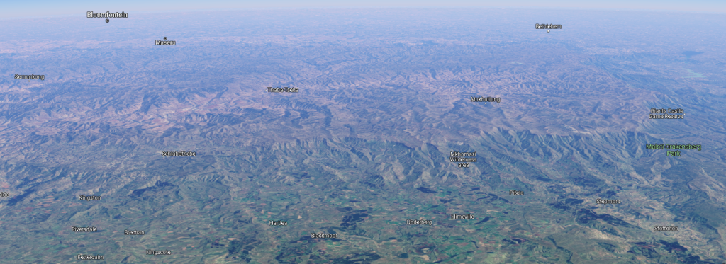
I am addicted to maps.google.com. If you sign in, you can hold the shift key to tilt the map, giving you the ability to see elevation.

Here is an isometric aerial view of Lesotho; the boundaries are evident. It is set on a high plateau and carved with deep ravines. The tan and brown mountainous regions in the center and toward the back are Lesotho, and the green, relatively gentle terrain toward the front of the image is South Africa.
The oversimplified version: the people of Lesotho originally fled from the rising Zulu nation and defended themselves as the primary push of the Zulu was northward. Things stabilized somewhat until the French-supported Dutch (the Boer republic) on Lesotho’s doorstep encroached on their lands. A tussle ensued (Boer wars) and Lesotho emerged as a British protectorate (1868), and its own sovereign nation in 1966.
Tags: Geography, Geology, I Have The High Ground Anakin