Irrigating Grace, Idaho


“Niter Ice Cave,” “Last Chance Canal,” and the town of “Grace” are all associated with Gem Valley on the Bear River in southern Idaho. The ice cave formed at the edge of a lava flow (I don’t know how–that’s not important right now,) Last Chance Canal refers to the desperate struggle to irrigate crops in the fertile valley before the land owner’s water rights expired, and “Grace” is the name of the Mormon community that flourished as a result.

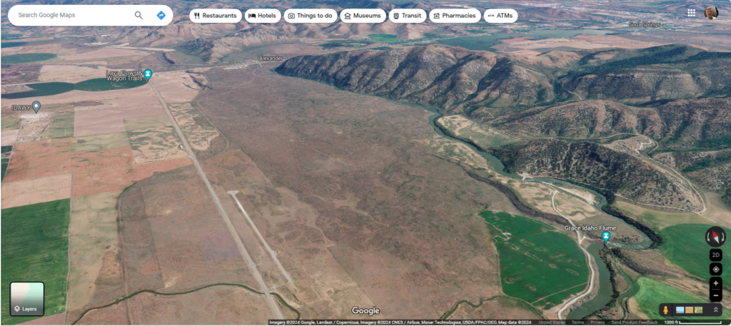
In this fantastic image, the Bear River flows into Gem Valley from the top right corner, but instead of filling the valley with wholesome, hydrological goodness, the river appears to have been interrupted by a lava flow that fills the central third of the image. Crops on the left, mountains on the right, and igneous rock down the middle. And so, the water flows between the mountains and lava, doing nobody any good.

However, the height differential creates a unique opportunity for irrigation: if you can dig through old igneous formations carefully, you can irrigate the whole valley. The Last Chance Canal Company accomplished their goal, and added a bit of hydroelectric power into the deal as well. Last Chance Canal Historical Marker (hmdb.org)
Grasberg Mine, Indonesia

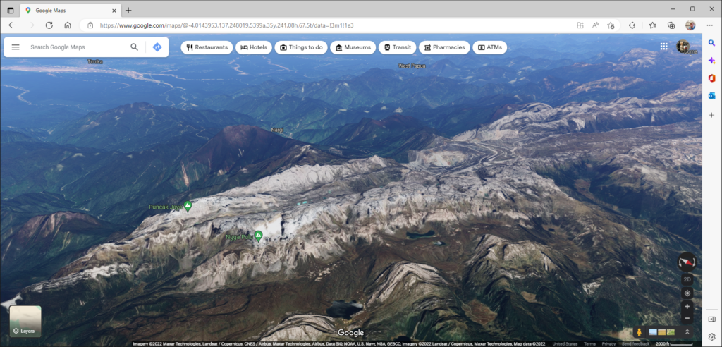
Grasberg mine is located near one of the tallest mountains on earth: Puncak Jaya or Carstenz Pyramid–one of the Seven Summits. Copper deposits near the peak were discovered by a geologist on a climbing expedition in 1936. In the image, the mountain peaks are to the left, and Grasberg open pit mine is to the right of center. It looks like an eye here, but from a top-down aspect, it appears more like a bullseye with concentric rings leading downward into a pit; the rings being roads that trucks use to transport ore up from the center of the mine. The ore from Grasberg is primarily copper, with gold and silver being secondary and tertiary products.

As with all mining operations, there are significant ecological considerations, such as heavy metals contaminating runoff, high acidity of the runoff, and excessively turbid water. As a result, native fish have all but disappeared from the rivers.

One of the things that I find amazing about this place is obviously the elevation–there are glaciers nearby–but what I find incredible is how much work it took to build the infrastructure in such a remote place and the logistics to continue operation. How well do gasoline engines run at this altitude? Where do the employees live? How does the ore get to a port or refinery, and how can it all be operated in an environmentally responsible manner?

Lesotho: One country surrounded by another

I am addicted to maps.google.com. If you sign in, you can hold the shift key to tilt the map, giving you the ability to see elevation.

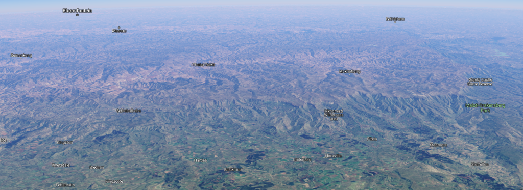
Here is an isometric aerial view of Lesotho; the boundaries are evident. It is set on a high plateau and carved with deep ravines. The tan and brown mountainous regions in the center and toward the back are Lesotho, and the green, relatively gentle terrain toward the front of the image is South Africa.

The oversimplified version: the people of Lesotho originally fled from the rising Zulu nation and defended themselves as the primary push of the Zulu was northward. Things stabilized somewhat until the French-supported Dutch (the Boer republic) on Lesotho’s doorstep encroached on their lands. A tussle ensued (Boer wars) and Lesotho emerged as a British protectorate (1868), and its own sovereign nation in 1966.

Tags: Geography, Geology, I Have The High Ground Anakin